

Select Category
General

Garmin 0101080091 Bluechart® G3 Updates For Garmin With Pre-Loaded Charts, Western Canada Coastal Charts, Microsd™/Sd™ - 010-10800-91 - 322-0101080091F1
The g3 cartography update cards provide exceptional coverage and detail for saltwater and freshwater pursuits. When it's time to update these cards will work regardless of which g3 charts are preloaded on your compatible chartplotter. For Garmin Chartplotters Only. Some features require subscription. See Navionics website for compatibility, coverage details & full list of features.
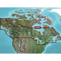
Garmin 0101080092 Bluechart® G3 Updates For Garmin With Pre-Loaded Charts, Canada Inland Maps, Microsd™/Sd™ - 010-10800-92 - 322-0101080092F1
The g3 cartography update cards provide exceptional coverage and detail for saltwater and freshwater pursuits. When it's time to update these cards will work regardless of which g3 charts are preloaded on your compatible chartplotter. For Garmin Chartplotters Only. Some features require subscription. See Navionics website for compatibility, coverage details & full list of features.
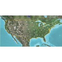
Garmin 0101080093 Bluechart® G3 Updates For Garmin With Pre-Loaded Charts, U.S. Inland Maps, Microsd™/Sd™ - 010-10800-93 - 322-0101080093F1
The g3 cartography update cards provide exceptional coverage and detail for saltwater and freshwater pursuits. When it's time to update these cards will work regardless of which g3 charts are preloaded on your compatible chartplotter. For Garmin Chartplotters Only. Some features require subscription. See Navionics website for compatibility, coverage details & full list of features.
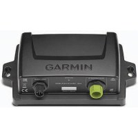
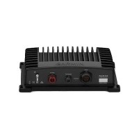
Garmin 0101105267 Reactor™ 40 Course Computer Unit - 010-11052-67 - 322-0101105267F1
This CCU is the brain of the Reactor 40 autopilot system, containing sensory equipment used to determine heading and rate of turn. Connect the CCU to the NMEA 2000 network to communicate with your GHC™ 20 and optional NMEA 2000-compatible devices.
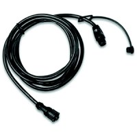
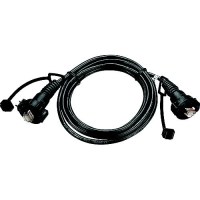
Garmin 0101107600 Nmea 2000 Backbone Cable, 2M - 010-11076-00 - 322-0101107600F1
NMEA 2000 Backbone 2M
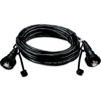
Garmin 0101107601 Nmea 2000 6M Drop Cable - 010-11076-01 - 322-0101107601F1
NMEA2000 6M Drop Cable
Garmin 0101107602 Nmea 2000 10M Drop Cable - 010-11076-02 - 322-0101107602F1
NMEA 2000 10M Drop Cable

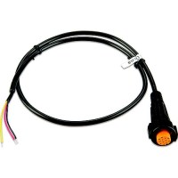
Garmin 0101107900 Nmea 2000 Power Cable, 2M - 010-11079-00 - 322-0101107900F1
NMEA 2000 Power Cable
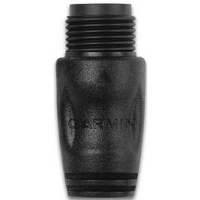
Garmin 0101108000 Nmea 2000 Male Terminator - 010-11080-00 - 322-0101108000F1
NMEA 2000 Male Terminator

Garmin 0101108100 Nmea 2000 Female Terminator - 010-11081-00 - 322-0101108100F1
NMEA 2000 Female Terminator

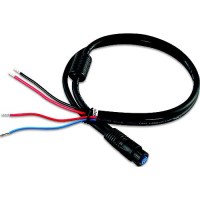
Garmin 0101142501 Threaded Power Cable - 010-11425-01 - 322-0101142501F1
Power your multi-function display (MFD) with this 6 ft (1.8 m) power cable. Separate locking O-ring allows you to thread/install the cable through smaller holes drilled into the boat. Once installed, the locking ring connects to the plug.
Garmin 0101142509 Marine Network Cables, 6' - 010-11425-09 - 322-0101142509F1
Marine Network Cables offer an additional 6 feet (1.83 m) or 20 feet (6.1 m) of cable length (each sold separately).
Garmin 0101142510 Marine Network Cables, 20' - 010-11425-10 - 322-0101142510F1
Our Garmin Marine Network cables offer an additional 6 feet (1.83 m) or 20 feet (6.1 m) of cable length (each sold separately).
Garmin 0101153200 Rudder Feedback Cable - 010-11532-00 - 322-0101153200F1
Garmin 0101153300 Actuator Power Cable - 010-11533-00 - 322-0101153300F1
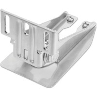
Garmin 0101200611 Hd Transom Mount With Spray Shield - 010-12006-11 - 322-0101200611F1
Easily attach your compatible 4-, 8- or 12-pin transducer to the transom of your boat with this mount that provides excellent sonar returns at all speeds. Since the transducer is in the water at all times, the mount does not protect the transducer from underwater obstructions and some drag on the boat will occur. The included transducer spray shield reduces excessive water spray from your compatible transducer when your boat is running at high speedsYou also can mount the transducer to the step of your boat with this mount to allow angle adjustment of the transducer so it is parallel with the water surface; this will create no drag on the boat. And since the transducer is out of the water with this mounting style, sonar will not track bottom when the boat is on plane. See Garmin website for compatible devices.
Garmin 0101206700 Power Cable For Gmr™ Radars, 48' - 010-12067-00 - 322-0101206700F1
Power your Garmin radar with this 48 foot long threaded cable.
Garmin 0101239030 J1939 Cable, Gpsmap® 8400/8600 - 010-12390-30 - 322-0101239030F1
Connect your GPSMAP 8400 or 8600 series chartplotter to a J1939 network to gain access to features, such as engine or generator monitoring. Like the NMEA 2000 network, the J1939 network follows a standard and uses proprietary messages.
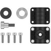
Garmin 0101244001 Garmin Flush Mount Kit - 010-12440-01 - 322-0101244001F1
Easily position your compatible device against most flat surfaces in your boat with this flush mount kit. It includes hardware, instructions and a template for sleek installation.
Garmin 0101244002 Garmin Flush Mount Kit - 010-12440-02 - 322-0101244002F1
Easily position your compatible device against most flat surfaces in your boat with this flush mount kit. It includes hardware, instructions and a template for sleek installation.
Garmin 0101252803 Bluenet™ Network Cable, 50' - 010-12528-03 - 322-0101252803F1
Garmin BlueNet marine network cables offer additional cable lengths to help with installations. Additional sizes sold separately.

Garmin 0101252810 Bluenet™ Network Cable (Right Angle), 50' - 010-12528-10 - 322-0101252810F1
Garmin BlueNet marine network cables offer additional cable lengths to help with installations. Additional sizes sold separately.
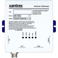
Garmin 0101252811 Bluenet™ Network Cable, 1' - 010-12528-11 - 322-0101252811F1
This short Garmin BlueNet™ network cable is used to connect a Garmin BlueNet™ 20 switch or Garmin BlueNet™ 30 gateway to each other, or other Garmin BlueNet network products.
Garmin 0101252830 Bluenet™ Network Cable, 6' - 010-12528-30 - 322-0101252830F1
Garmin BlueNet marine network cables offer additional cable lengths to help with installations. Additional sizes sold separately.
Garmin 0101252831 Bluenet™ Network Cable, 20' - 010-12528-31 - 322-0101252831F1
Garmin BlueNet marine network cables offer additional cable lengths to help with installations. Additional sizes sold separately.
Garmin 0101253120 Marine Network To Fusion® Cable, 6' - 010-12531-20 - 322-0101253120F1
Use these adapter cables to link your GPSMAP® Series chartplotter to a compatible Fusion® stereo. These cables will connect a Garmin Marine Network port to an RJ45 port and are offered in male and female connector varieties to fit your specific system.

Garmin 0101253121 Marine Network To Fusion® Cable, 6' - 010-12531-21 - 322-0101253121F1
Use these adapter cables to link your GPSMAP® Series chartplotter to a compatible Fusion® stereo. These cables will connect a Garmin Marine Network port to an RJ45 port and are offered in male and female connector varieties to fit your specific system.
Garmin 0101267610 Panoptix Ice Fishing Pole Mount - 010-12676-10 - 322-0101267610F1
This pole mount allows you to rotate your Panoptix PS22-TR LiveVü Forward and Down transducer, while under the ice, to locate fish around you. The mount can go about 4.25' (maximum depth) below the surface.
Garmin 0101267615 0 Degree Livescope Pole Mount - 010-12676-15 - 322-0101267615F1
Position your Panoptix LiveScope™ LVS32 transducer on this 0 degree pole mount for an optimal viewing angle while ice fishing (works for open water fishing too).
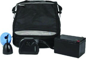
Garmin 0101267620 Panoptix™ Ice Fishing Kit - 010-12676-20 - 322-0101267620F1
Includes everything you need to take your 7" or 9" ECHOMAP Plus combo and transform your ice fishing experience.Kit Includes:Panoptix PS22-TR transducer with both LiveVü Forward and LiveVü Down modesGT10HN-IF ice fishing transducer w/ CHIRP traditional sonar with selectable narrow beam angle (8 to 16°)Rugged, glove-friendly case Kit accessories include a swivel pole mount for the Panoptix transducer, foam float and cable grommet, 12Ah battery, charger, power cable and transducer adapter cableFishfinder sold separately, see Garmin website for compatibility
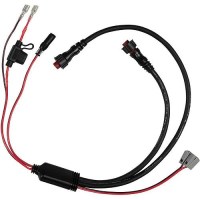
Garmin 0101267640 Panoptix™ Power Cable - 010-12676-40 - 322-0101267640F1
Connect your Panoptix™ LiveScope System or Panoptix PS22 transducer and compatible ECHOMAP chartplotter to the battery of your compatible Panoptix ice fishing bundle with this power cable. It also includes a convenient charge port plug and 10A fuse holder. Compatible with the Panoptix™ LiveScope Ice Fishing Bundle.
Garmin 0101279802 Bail Mount With Knobs - 010-12798-02 - 322-0101279802F1
Bail Mount w/Knobs
Garmin 0101283223 Nose Cone, White - 010-12832-23 - 322-0101283223F1
Nose Cone
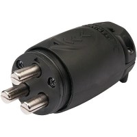
Garmin 0101283241 70A Power Plug - 010-12832-41 - 322-0101283241F1
Use to add 70A power to your Force trolling motor.
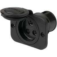
Garmin 0101283242 70A Receptacle - 010-12832-42 - 322-0101283242F1
Use to add 70A power to your Force trolling motor.
Garmin 0101283255 Deck Mount Stabilizer Kit, Black - 010-12832-55 - 322-0101283255F1
Deck Mount Stabilizer Kit
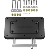
Garmin 0101283260 Quick Release Plate System, Black - 010-12832-60 - 322-0101283260F1
Quick Release Plate System
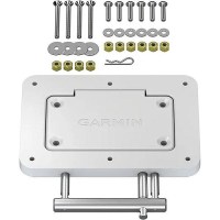
Garmin 0101283261 Quick Release Plate System, White - 010-12832-61 - 322-0101283261F1
Quick Release Plate System
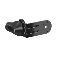
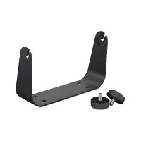
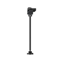
Garmin 0101283270 Livescope™ Mounting Bracket, Black - 010-12832-70 - 322-0101283270F1
LiveScope™ Mounting Bracket

Garmin 0101283300 Trolling Motor Handheld Remote Control - 010-12833-00 - 322-0101283300F1
Handheld Remote Control
Garmin 0101283400 Trolling Motor Foot Pedal Control - 010-12834-00 - 322-0101283400F1
Foot Pedal Control
Garmin 0101295400 Panoptix Livescope™ Gls™ 10 Sonar Module - 010-12954-00 - 322-0101295400F1
Add Panoptix LiveScope™ Scanning Sonar to Your Compatible Chartplotter. The easy-to-install, networkable GLS 10 sonar black box allows you to see live, real-time scanning sonar. Add the LVS32 transducer model to see easy-to-interpret live scanning sonar images of structure, bait and fish swimming below and around your boat. And you can share sonar images seamlessly across multiple networked chartplotters. LiveScope Down mode allows you to see live, easy-to-interpret scanning sonar images of structure and swimming fish in incredible detail below your boat - up to 200' - even while your boat is stationary.LiveScope Forward mode is an excellent tool for scouting and fishing out ahead of your cast. you're looking at live, highly detailed and easy-to-interpret scanning sonar images of structure and fish swimming all around your boat - up to 200' - even while your boat is stationary. Includes: GLS 10 sonar module, power cable, 2 meter Garmin marine network cable, small connector, network adapter cable, mounting hardware.
Garmin 0101297000 Panoptix Livescope™ Perspective Mode Mount - 010-12970-00 - 322-0101297000F1
The Perspective Mode Mount takes your Panoptix LiveScope™ real-time scanning sonar to the next level. Attach your LVS32 transducer to this mount to add an overhead sonar view that's perfect for scouting and fishing in shallow water. One mount, three views so you can see all around your boat in real timeEasily mounts to your trolling motorYour chartplotter automatically detects which mode you're inRough waters won't affect sonar so you can fish through anything
Garmin 0101297301 Vieo™ Fit Kit For Mercedes Sprinter Fit Kit - 010-12973-01 - 322-0101297301F1
Use the mounting bracket and hardware that matches your vehicle on your Vieo RV 51 stereo dock.

Garmin 0101297305 Vieo™ Fit Kit For Promaster Fit Kit - 010-12973-05 - 322-0101297305F1
Use the mounting bracket and hardware that matches your vehicle on your Vieo RV 51 stereo dock.

Garmin 0101297308 Vieo™ Fit Kit For Ford E-Series Fit Kit - 010-12973-08 - 322-0101297308F1
Use the mounting bracket and hardware that matches your vehicle on your Vieo RV 51 stereo dock.
Garmin 0101297315 Vieo™ Fit Kit For 2006-18 Mercedes Sprinter Fit Kit - 010-12973-15 - 322-0101297315F1
Use the mounting bracket and hardware that matches your vehicle on your Vieo RV 51 stereo dock.
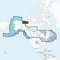
Garmin 0101317700 Navionics+™ Updates For Garmin With Built-In Charts, U.S. & Coastal Canada, Microsd™/Sd™ - 010-13177-00 - 322-0101317700F1
If your chartplotter came with built-in BlueChart® g3 coastal charts or LakeVü™ g3 inland maps, a plug-in microSD™ card makes it easy to upgrade with our latest Garmin Navionics+ all-in-one mapping solution. Check chartplotter compatibility. Includes a 1-year subscription.For Garmin Chartplotters Only. Some features require subscription. See Navionics website for compatibility, coverage details & full list of features.
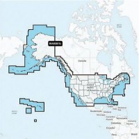
Garmin 0101318000 Navionics+™ Updates For Garmin With Built-In Charts, Canada & Alaska, Microsd™/Sd™ - 010-13180-00 - 322-0101318000F1
If your chartplotter came with built-in BlueChart® g3 coastal charts or LakeVü™ g3 inland maps, a plug-in microSD™ card makes it easy to upgrade with our latest Garmin Navionics+ all-in-one mapping solution. Check chartplotter compatibility. Includes a 1-year subscription.For Garmin Chartplotters Only. Some features require subscription. See Navionics website for compatibility, coverage details & full list of features.
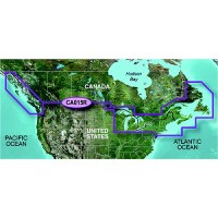
Garmin 010C101920 Bluechart® G3 - 010-C1019-20 - 322-010C101920F1
Has all the detail of traditional BlueChart, but with 3D perspective, richer detail and content. Smoother layering and better integration of map graphics, faster redraws and more cohesive panning, scrolling and zooming. Realistic navigation features shows everything from shaded depth contours and coastlines to spot soundings, navaids, port plans, wrecks, obstructions, restricted areas, IALA symbols and more. 010-C1019-20 Canadian Coast & Great LakesProvides detailed coastal coverage of the North America East coast from Nain, NL to Raritan Bay, NY featuring Newfoundland, 'e d'Anticosti, New York Harbor, and full U.S. and Canadian coverage of the Great Lakes in their entirety. The North American west Coast is covered from Glacier Bay, AK to Aberdeen, WA featuring British Columbia, Vancouver, the Queen Charlotte Islands, & Puget Sound
Garmin 010C111400 Lakevu G3 Ultra Chart, Canada - 010-C1114-00 - 322-010C111400F1
Experience unparalleled coverage and brilliant detail on the water. LakeVü g3 Ultra inland water maps provide industry-leading coverage, clarity and detail with integrated Garmin and Navionics data, Auto Guidance technology and high-resolution relief shading. Provides industry-leading coverage, clarity and detail for more than 13,500 lakes with 1' contours that feature integrated Garmin and Navionics® dataAuto Guidance technology uses your desired depth and overhead clearance to calculate routes and show a suggested path to followHigh-resolution relief shading combines color and shadow to give you an easy-to-interpret, clearer view of bottom structure than contour lines aloneCovers more than 13,500 HD lakes with up to 1' contours
Garmin 010C120400 Lakevu G3 Ultra Chart, U.S. East - 010-C1204-00 - 322-010C120400F1
Experience unparalleled coverage and brilliant detail on the water. LakeVü g3 Ultra inland water maps provide industry-leading coverage, clarity and detail with integrated Garmin and Navionics data, Auto Guidance technology and high-resolution relief shading. Provides industry-leading coverage, clarity and detail for more than 11,500 lakes with 1' contours that feature integrated Garmin and Navionics® dataAuto Guidance technology uses your desired depth and overhead clearance to calculate routes and show a suggested path to followHigh-resolution relief shading combines color and shadow to give you an easy-to-interpret, clearer view of bottom structure than contour lines aloneCovers more than 11,500 HD lakes with up to 1' contours, and more than 100 Garmin Elite survey lakes
Garmin 010C120500 Lakevu G3 Ultra Chart, U.S. West - 010-C1205-00 - 322-010C120500F1
Experience unparalleled coverage and brilliant detail on the water. LakeVü g3 Ultra inland water maps provide industry-leading coverage, clarity and detail with integrated Garmin and Navionics data, Auto Guidance technology and high-resolution relief shading. Provides industry-leading coverage, clarity and detail for more than 5,900 lakes with 1' contours that feature integrated Garmin and Navionics® dataAuto Guidance technology uses your desired depth and overhead clearance to calculate routes and show a suggested path to followHigh-resolution relief shading combines color and shadow to give you an easy-to-interpret, clearer view of bottom structure than contour lines aloneCovers more than 5,900 HD lakes with up to 1' contours, and more than 75 Garmin Elite survey lakes
Garmin 010C128720 Navionics+™ Chart, U.S. & Coastal Canada - 010-C1287-20 - 322-010C128720F1
PLOT YOUR PARADISE - with the best, most up-to-date Garmin Navionics+™ marine cartography on your compatible Garmin chartplotter. For offshore or inland waters, get detail-rich integrated mapping, shaded depth contours, advanced Auto Guidance+™ technology and access to daily updates via the ActiveCaptain app. Card type SD/MSD.For Garmin Chartplotters Only. Some features require subscription. See Navionics website for compatibility, coverage details & full list of features.
Garmin 010C128820 Navionics+™ Chart, Canada & Alaska - 010-C1288-20 - 322-010C128820F1
PLOT YOUR PARADISE - with the best, most up-to-date Garmin Navionics+™ marine cartography on your compatible Garmin chartplotter. For offshore or inland waters, get detail-rich integrated mapping, shaded depth contours, advanced Auto Guidance+™ technology and access to daily updates via the ActiveCaptain app. Card type SD/MSD.For Garmin Chartplotters Only. Some features require subscription. See Navionics website for compatibility, coverage details & full list of features.

Garmin 010C128900 Navionics Vision+™ For Garmin, U.S. North - 010-C1289-00 - 322-010C128900F1
PLOT YOUR PARADISE - with the best, most up-to-date Garmin Navionics Vision+™ premium marine cartography on your compatible Garmin chartplotter. For offshore or inland waters, get premier-grade chart features, including detail-rich integrated mapping, high-resolution relief shading, 3D views, satellite imagery, advanced Auto Guidance+™ technology and access to daily updates via the ActiveCaptain® app. Card type SD/MSD.For Garmin Chartplotters Only. Some features require subscription. See Navionics website for compatibility, coverage details & full list of features.
Garmin 010C128920 Navionics+™ Chart, U.S. North - 010-C1289-20 - 322-010C128920F1
PLOT YOUR PARADISE - with the best, most up-to-date Garmin Navionics+™ marine cartography on your compatible Garmin chartplotter. For offshore or inland waters, get detail-rich integrated mapping, shaded depth contours, advanced Auto Guidance+™ technology and access to daily updates via the ActiveCaptain app. Card type SD/MSD.For Garmin Chartplotters Only. Some features require subscription. See Navionics website for compatibility, coverage details & full list of features.
Garmin 010C129000 Navionics Vision+™ For Garmin, U.S. South - 010-C1290-00 - 322-010C129000F1
PLOT YOUR PARADISE - with the best, most up-to-date Garmin Navionics Vision+™ premium marine cartography on your compatible Garmin chartplotter. For offshore or inland waters, get premier-grade chart features, including detail-rich integrated mapping, high-resolution relief shading, 3D views, satellite imagery, advanced Auto Guidance+™ technology and access to daily updates via the ActiveCaptain® app. Card type SD/MSD.For Garmin Chartplotters Only. Some features require subscription. See Navionics website for compatibility, coverage details & full list of features.
Garmin 010C129020 Navionics+™ Chart, U.S. South - 010-C1290-20 - 322-010C129020F1
PLOT YOUR PARADISE - with the best, most up-to-date Garmin Navionics+™ marine cartography on your compatible Garmin chartplotter. For offshore or inland waters, get detail-rich integrated mapping, shaded depth contours, advanced Auto Guidance+™ technology and access to daily updates via the ActiveCaptain app. Card type SD/MSD.For Garmin Chartplotters Only. Some features require subscription. See Navionics website for compatibility, coverage details & full list of features.
Garmin 010C129100 Navionics Vision+™ For Garmin, U.S. East - 010-C1291-00 - 322-010C129100F1
PLOT YOUR PARADISE - with the best, most up-to-date Garmin Navionics Vision+™ premium marine cartography on your compatible Garmin chartplotter. For offshore or inland waters, get premier-grade chart features, including detail-rich integrated mapping, high-resolution relief shading, 3D views, satellite imagery, advanced Auto Guidance+™ technology and access to daily updates via the ActiveCaptain® app. Card type SD/MSD.For Garmin Chartplotters Only. Some features require subscription. See Navionics website for compatibility, coverage details & full list of features.
Garmin 010C129120 Navionics+™ Chart, U.S. East - 010-C1291-20 - 322-010C129120F1
PLOT YOUR PARADISE - with the best, most up-to-date Garmin Navionics+™ marine cartography on your compatible Garmin chartplotter. For offshore or inland waters, get detail-rich integrated mapping, shaded depth contours, advanced Auto Guidance+™ technology and access to daily updates via the ActiveCaptain app. Card type SD/MSD.For Garmin Chartplotters Only. Some features require subscription. See Navionics website for compatibility, coverage details & full list of features.
Garmin 010C129200 Navionics Vision+™ For Garmin, U.S. West - 010-C1292-00 - 322-010C129200F1
PLOT YOUR PARADISE - with the best, most up-to-date Garmin Navionics Vision+™ premium marine cartography on your compatible Garmin chartplotter. For offshore or inland waters, get premier-grade chart features, including detail-rich integrated mapping, high-resolution relief shading, 3D views, satellite imagery, advanced Auto Guidance+™ technology and access to daily updates via the ActiveCaptain® app. Card type SD/MSD.For Garmin Chartplotters Only. Some features require subscription. See Navionics website for compatibility, coverage details & full list of features.
Garmin 010C129220 Navionics+™ Chart, U.S. West - 010-C1292-20 - 322-010C129220F1
PLOT YOUR PARADISE - with the best, most up-to-date Garmin Navionics+™ marine cartography on your compatible Garmin chartplotter. For offshore or inland waters, get detail-rich integrated mapping, shaded depth contours, advanced Auto Guidance+™ technology and access to daily updates via the ActiveCaptain app. Card type SD/MSD.For Garmin Chartplotters Only. Some features require subscription. See Navionics website for compatibility, coverage details & full list of features.
Garmin 8616 Gpsmap® 8600 Gps Chartplotter W/Touchscreen - 010-02093-50 - 322-0100209350F1
Get wider viewing angles and superior clarity on the touchscreen with a full HD in-plane switching (IPS) displayNavigate confidently with built-in Garmin Navionics+™ inland and coastal mappingEasily build your marine system using the best of network connectivityFrom ANT® technology to Wi-Fi® networking, there are countless ways to connect to your systemSmartMode™ station controls, everything is designed to give you quick, one-touch access to the information you needInstall multiple displays, either flat mounted edge-to-edge for a sleek glass helm look or mounted flush - creating a stunning helmOptional, easy-to-use GRID 20 remote input device provides intuitive remote access and control of your entire Garmin marine systemPair your chartplotter with Garmin live sonar options (transducer sold separately) to see all around your boat in real timeUnparalleled coverage and detail with built-in Garmin Navionics+™ integrated coastal and inland mapping that includes Auto Guidance+™ technology3 and a 1-year subscription for downloadable daily updates and more on select chartplottersSailassistT™ Sailing features View laylines, race start line guidance, enhanced wind rose, heading and course-over-ground lines, true wind data fields and tide/current/time slider, wind angle, set and drift, wind speed, polars and moreSailing Polars, use the polar table to see key data, including how fast you should go at a certain wind angle and speed - so you know whether you need to adjust sail trim In The Box: GPSMAP unit, Power cable, NMEA 2000® drop cable, NMEA 2000 T-connector, Flush mount kit, Sun cover, Trim piece snap covers.
Garmin Gcv™ 10 Scanning Sonar Module - 010-01156-02 - 322-0100115602F1
The GCV 10 scanning sonar module provides clear scanning sonar images and adds both SideVü and DownVü with CHIRP scanning sonar technologies to your compatible Garmin echoMAP or GPSMAP series combo as well as your GPSMAP 8000 Glass Helm series (see compatible devices). CHIRP technology sweeps through a range of frequencies to give you an ultra-clear sonar picture of objects, structure and fish that pass below (DownVü) and to the sides (SideVü) of the boat. Together with your combo's HD-ID™ sonar, you get an excellent search and confirmation tool for advanced fishfinding in both fresh and saltwater. In addition, the GCV 10 can coexist on the same network with other black box sonars. For example, if you currently have a GPSMAP 8000 Glass Helm, a GSD™ 24 advanced sonar module or a GSD 26 CHIRP professional sonar module on your Garmin Marine Network, you can greatly enhance your fishing capabilities by adding a GCV 10.For use with compatible echoMAP™ and GPSMAP® series combos as well as GPSMAP 8000 Glass Helm series (see compatible devices)Provides both Garmin DownVü™ and Garmin SideVü™ with CHIRP scanning sonar technology for a high-frequency, ultra-clear sonar picture of objects, structure and fishCoexists on same network with other black box sonars, and allows networked devices to share internal sonar with other networked devices3 network ports provided for advanced networking for multiple units

Garmin Gmi 20 Marine Instrument Display - 010-01140-00 - 322-0100114000F1
Clearly display depth, speed, wind and 100+ marine and vessel parameters when connected to appropriate sensors Large, bright 4" color glass-bonded lens display with anti-glare finishEasy to read from a distance170° viewing angleEnhanced night time readability with backlight dimmer and full color or new red/black or green/black color schemesEnhanced daylight readability with new high contrast color option
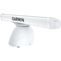
Garmin K100001224 Gmr™ Xhd3 Open Array Radar, 4', 4Kw - K10-00012-24 - 322-K100001224F1
Combining high-definition imaging with the latest Garmin platform technology, these open-array radars offer superior weather, obstacle and traffic detection for mariners cruising or fishing offshore. 4kW OutputScan averaging technologyImproved target-size processingAngular target-size adjustmentDual range with overlayDynamic auto gainHigh-resolution radarDual-radar supportDynamic sea filterAuto bird gainMarpa target trackingGuard zone; receive an alarm when an object enters the zoneRange and bearing cues100-Knot commercial grade wind ratingQuiet open-array drive motor
Garmin K100001225 Gmr™ Xhd3 Open Array Radar, 6', 4Kw - K10-00012-25 - 322-K100001225F1
Combining high-definition imaging with the latest Garmin platform technology, these open-array radars offer superior weather, obstacle and traffic detection for mariners cruising or fishing offshore. 4kW OutputScan averaging technologyImproved target-size processingAngular target-size adjustmentDual range with overlayDynamic auto gainHigh-resolution radarDual-radar supportDynamic sea filterAuto bird gainMarpa target trackingGuard zone; receive an alarm when an object enters the zoneRange and bearing cues100-Knot commercial grade wind ratingQuiet open-array drive motor
Garmin K100001226 Gmr™ Xhd3 Open Array Radar, 4', 12Kw - K10-00012-26 - 322-K100001226F1
Combining high-definition imaging with the latest Garmin platform technology, these open-array radars offer superior weather, obstacle and traffic detection for mariners cruising or fishing offshore. 12kW OutputScan averaging technologyImproved target-size processingAngular target-size adjustmentDual range with overlayDynamic auto gainHigh-resolution radarDual-radar supportDynamic sea filterAuto bird gainMarpa target trackingGuard zone; receive an alarm when an object enters the zoneRange and bearing cues100-Knot commercial grade wind ratingQuiet open-array drive motor
Garmin K100001227 Gmr™ Xhd3 Open Array Radar, 6', 12Kw - K10-00012-27 - 322-K100001227F1
Combining high-definition imaging with the latest Garmin platform technology, these open-array radars offer superior weather, obstacle and traffic detection for mariners cruising or fishing offshore. 12kW OutputScan averaging technologyImproved target-size processingAngular target-size adjustmentDual range with overlayDynamic auto gainHigh-resolution radarDual-radar supportDynamic sea filterAuto bird gainMarpa target trackingGuard zone; receive an alarm when an object enters the zoneRange and bearing cues100-Knot commercial grade wind ratingQuiet open-array drive motor
Garmin K100001228 Gmr™ Xhd3 Open Array Radar, 4', 25Kw - K10-00012-28 - 322-K100001228F1
Combining high-definition imaging with the latest Garmin platform technology, these open-array radars offer superior weather, obstacle and traffic detection for mariners cruising or fishing offshore. 25kW OutputScan averaging technologyImproved target-size processingAngular target-size adjustmentDual range with overlayDynamic auto gainHigh-resolution radarDual-radar supportDynamic sea filterAuto bird gainMarpa target trackingGuard zone; receive an alarm when an object enters the zoneRange and bearing cues100-Knot commercial grade wind ratingQuiet open-array drive motor
Garmin K100001229 Gmr™ Xhd3 Open Array Radar, 6', 25Kw - K10-00012-29 - 322-K100001229F1
Combining high-definition imaging with the latest Garmin platform technology, these open-array radars offer superior weather, obstacle and traffic detection for mariners cruising or fishing offshore. 25kW OutputScan averaging technologyImproved target-size processingAngular target-size adjustmentDual range with overlayDynamic auto gainHigh-resolution radarDual-radar supportDynamic sea filterAuto bird gainMarpa target trackingGuard zone; receive an alarm when an object enters the zoneRange and bearing cues100-Knot commercial grade wind ratingQuiet open-array drive motor
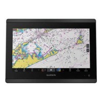
Garmin Xxx Gpsmap® 8610 Gps Chartplotter W/Touchscreen - 010-02091-50 - 322-0100209150F1
Get wider viewing angles and superior clarity on the touchscreen with a full HD in-plane switching (IPS) displayNavigate confidently with built-in Garmin Navionics+™ inland and coastal mappingEasily build your marine system using the best of network connectivityFrom ANT® technology to Wi-Fi® networking, there are countless ways to connect to your systemSmartMode™ station controls, everything is designed to give you quick, one-touch access to the information you needInstall multiple displays, either flat mounted edge-to-edge for a sleek glass helm look or mounted flush - creating a stunning helmOptional, easy-to-use GRID 20 remote input device provides intuitive remote access and control of your entire Garmin marine systemPair your chartplotter with Garmin live sonar options (transducer sold separately) to see all around your boat in real timeUnparalleled coverage and detail with built-in Garmin Navionics+™ integrated coastal and inland mapping that includes Auto Guidance+™ technology3 and a 1-year subscription for downloadable daily updates and more on select chartplottersSailassistT™ Sailing features View laylines, race start line guidance, enhanced wind rose, heading and course-over-ground lines, true wind data fields and tide/current/time slider, wind angle, set and drift, wind speed, polars and moreSailing Polars, use the polar table to see key data, including how fast you should go at a certain wind angle and speed - so you know whether you need to adjust sail trim In The Box: GPSMAP unit, Power cable, NMEA 2000® drop cable, NMEA 2000 T-connector, Flush mount kit, Sun cover, Trim piece snap covers.
Garmin Xxx Gpsmap® 8612 Gps Chartplotter W/Touchscreen - 010-02092-50 - 322-0100209250F1
Get wider viewing angles and superior clarity on the touchscreen with a full HD in-plane switching (IPS) displayNavigate confidently with built-in Garmin Navionics+™ inland and coastal mappingEasily build your marine system using the best of network connectivityFrom ANT® technology to Wi-Fi® networking, there are countless ways to connect to your systemSmartMode™ station controls, everything is designed to give you quick, one-touch access to the information you needInstall multiple displays, either flat mounted edge-to-edge for a sleek glass helm look or mounted flush - creating a stunning helmOptional, easy-to-use GRID 20 remote input device provides intuitive remote access and control of your entire Garmin marine systemPair your chartplotter with Garmin live sonar options (transducer sold separately) to see all around your boat in real timeUnparalleled coverage and detail with built-in Garmin Navionics+™ integrated coastal and inland mapping that includes Auto Guidance+™ technology3 and a 1-year subscription for downloadable daily updates and more on select chartplottersSailassistT™ Sailing features View laylines, race start line guidance, enhanced wind rose, heading and course-over-ground lines, true wind data fields and tide/current/time slider, wind angle, set and drift, wind speed, polars and moreSailing Polars, use the polar table to see key data, including how fast you should go at a certain wind angle and speed - so you know whether you need to adjust sail trim In The Box: GPSMAP unit, Power cable, NMEA 2000® drop cable, NMEA 2000 T-connector, Flush mount kit, Sun cover, Trim piece snap covers.

Gas Bravo I X 1.50/1 - 5237200Tp - 714-5-5237200Tpf1
New and fresh from the factory, the classic Bravo sterndrive look is still available on selected p/n's. They freature all of the latest improvements to the cone clutch and machining imporvements that make Bravo sterndrives best in class for shift smoothness and durable performance. Includes dual water pickup.
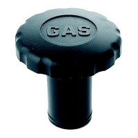
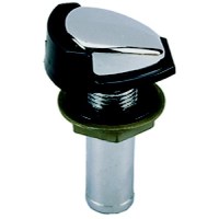
Gas Fill - 1613Dp0Blk - 9-1613Dp0Blkf1
Fiber reinforced, UV stabilized Black plastic. No deck plate key or ground wire required. Easy grip cap. O-ring and cap retainer included.
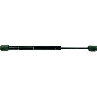
Gas Lift 12 To 20" 80Lb - Gs62810 - 11-Gs62810F1
Marine grade, exact fit OE replacement gas filled supports. Nitride coated annealed steel rods for corrosion resistance. Features engineered polymer rod ends, bronze bushings and a unique multi-lobe internal seal. Nitrogen filled. ALWAYS replace gas springs in pairs. Electrostatic black coated steel housing.
Gas Lift 8.5 To 12" 30Lb - Gs62670 - 11-Gs62670F1
Marine grade, exact fit OE replacement gas filled supports. Nitride coated annealed steel rods for corrosion resistance. Features engineered polymer rod ends, bronze bushings and a unique multi-lobe internal seal. Nitrogen filled. ALWAYS replace gas springs in pairs. Electrostatic black coated steel housing.
Gas Tank Vent W/Splash Shiel - 0506Dp4Chr - 9-0506Dp4Chrf1
Removable 30 mesh stainless steel wire screen flame arrester. Designed to meet the requirements of the USCG safety standards for gasoline fuel systems.
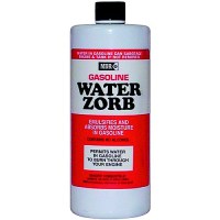
Gas Water Zorb 16 Oz. - Mdr-567 - 79-Mdr567F1
Disperses and recombines water right back into the fuel, allowing it to pass through filters and safely burn away with the fuel. Can be used as preventative maintenance. Water Zorb™ will totally recombine its own volume of water.
Gas Water Zorb 8 Oz. - Mdr-586 - 79-Mdr586F1
Disperses and recombines water right back into the fuel, allowing it to pass through filters and safely burn away with the fuel. Can be used as preventative maintenance. Water Zorb™ will totally recombine its own volume of water.
Gateway-Canp Mult Ss<8M0151748 - 8M0165589 - 710-8M0165589F1
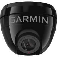
Gc 245 Marine Camera S Mnt Blk - 010-02892-11 - 322-0100289211F1
Now there's a high-resolution marine camera that takes the stress out of docking your boat. Enhance proximity awareness and confidence in close quarters with the GC 245 surface-mount camera. Distance markers specific to your boat1 and user-defined guidance lines1080p High-Resolution outputAvailable in sleek black or white finishSee camera feeds in fisheye or standard view; birdseye view also availableFull integration on the garmin marine network or garmin bluenet™ network
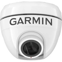
Gc 245 Marine Camera S Mnt Wht - 010-02892-10 - 322-0100289210F1
Now there's a high-resolution marine camera that takes the stress out of docking your boat. Enhance proximity awareness and confidence in close quarters with the GC 245 surface-mount camera. Distance markers specific to your boat1 and user-defined guidance lines1080p High-Resolution outputAvailable in sleek black or white finishSee camera feeds in fisheye or standard view; birdseye view also availableFull integration on the garmin marine network or garmin bluenet™ network

Gc 255 Marine Camera F Mnt Ss - 010-02892-00 - 322-0100289200F1
Take the stress out of docking your boat with a high-resolution marine camera. Enhance proximity awareness and confidence at the dock and in close quarters with the low-profile GC 255 flush-mount camera. Distance markers specific to your boat and user-defined guidance lines1080p High-Resolution outputDurable low-profile stainless steel finishSee camera feeds in fisheye or standard view; birdseye view also availableFull integration on the garmin marine network or garmin bluenet™ network
Gc Bravo Iii Dwp - 8M0046738 - 714-1656-8M0046738F1
Gc-150-1.92:1-25"-Xl - 8M0099221 - 714-1600-8M0099221F1
Gc-40-60Bf-2.33:1-4-Stk-20"-L - 9011G90 - 714-1667-9011G90F1
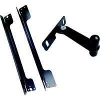
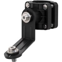
Ge Bmkitlatgpv10 Mounting Bracket - Bmkitlat-Gpv10 - 976-Bmkitlatgpv10F1
Includes Top & Bottom Mounting Bracket
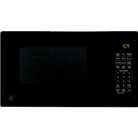
Ge Gcbk09N1Wbb 0.9 Cu. Ft. Capacity Built-In Microwave Oven, Black - Gcbk09N1Wbb - 976-Gcbk09N1Wbbf1
Built-In Microwave engineered for RVs Additional engineering to ensure proper air flow and stability. Designed to complement various cabinets, this stylish microwave requires either the stainless steel or black trim kit (JX1095STSS or JX1095STBB) for installationConvenience cooking controls express cook options and buttons for favorite foods10.63" Glass turntable that fits most dinner plates to ensure even cooking2 step child lock helps prevent unintended use by younger family members, with the option to deactivate it if not needed0.90 cu ft. Dimensions: 11-1/2" H x 19" W x 14-1/2" D