


Garmin
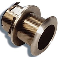
12° Tilt Bronze Thru-Hull Ducer - 010-10982-21 - 322-0101098221F1
Dual frequency (50/200kHz) transducer is specially designed to provide a vertical beam without a fairing block. Inside the housing, the ceramic element is tilted to provide built-in deadrise compensation. The resulting vertical beam provides excellent echo returns for more accurate depth readings. The nearly flush housing minimizes drag with only 3/16" extending outside of the hull. Includes a built-in temp sensor and handles up to 600 watts (RMS) power. Includes 39' cable.
20° Tilt Bronze Thru-Hull Ducer - 010-10982-20 - 322-0101098220F1
Dual frequency (50/200kHz) transducer is specially designed to provide a vertical beam without a fairing block. Inside the housing, the ceramic element is tilted to provide built-in deadrise compensation. The resulting vertical beam provides excellent echo returns for more accurate depth readings. The nearly flush housing minimizes drag with only 3/16" extending outside of the hull. Includes a built-in temp sensor and handles up to 600 watts (RMS) power. Includes 39' cable.

4' Xhd Open Array Antenna Only (Pedestal Sold Separately) - 010-01333-03 - 322-0100133303 Superseded By: 322-0100278000F1
xHD Open-Array Radar shows you what you're scanning sooner and in sharper detail. Powerful 4 kW X-band digital radars that combine 72 nm maximum range with high-definition targeting and selectable 24 or 48 RPM antenna rotation speeds. The 4' scanner has a 1.8° beamwidth for superior target separation. The advanced xHD electronics yield nearly 8 times more signal processing bandwidth than predecessor designs. Any network-compatible Garmin chartplotter can double as your radar screen and six pulse length/PRF settings help optimize target returns at all range scales. Pedestals and antennas sold separately.
Bluechart® G3 Vision Card, Cape Cod - 010-C0704-00 - 322-010C070400F1
Plug a BlueChart g3 Vision card into your compatible device's SD™ card slot and tremendously expand its mapping capabilities. High-resolution satellite imagery enhances chart depictions for superior situational awareness so you can navigate with a clear moving-map representation of your boat's position. It's the most realistic mapping display Garmin has ever offered in a chartplotter. High resolution satellite imagery, when overlaid on the chart, provides the mariner with unparalleled situational awarenessAerial reference photography provides "real world" photos of ports, harbors, marinas, waterways, navigation landmarks and other points of interest, offering the mariner another powerful tool for navigating unfamiliar watersMariner's Eye View perspective provides a bird's eye view from behind the boat showing the chart information for a quick, reliable and easy position fixFish Eye View 3D perspective provides an underwater view that visually represents the sea floor according to the chart's informationAuto Guidance technology searches chart data to suggest the best passage to a destinationFishing charts allow the mariner to hide navigation data from the SD card while leaving the bottom contours and depth soundings for their next fishing adventureIncludes tides, currents, marine services, coastal roads and points of interestDetailed BlueChart g3 maps are include 500, 600, 700, 4000, 5000, 6000, 7000
Bluechart® G3 Vision Card, Florida - 010-C0712-00 - 322-010C071200F1
Plug a BlueChart g3 Vision card into your compatible device's SD™ card slot and tremendously expand its mapping capabilities. High-resolution satellite imagery enhances chart depictions for superior situational awareness so you can navigate with a clear moving-map representation of your boat's position. It's the most realistic mapping display Garmin has ever offered in a chartplotter. High resolution satellite imagery, when overlaid on the chart, provides the mariner with unparalleled situational awarenessAerial reference photography provides "real world" photos of ports, harbors, marinas, waterways, navigation landmarks and other points of interest, offering the mariner another powerful tool for navigating unfamiliar watersMariner's Eye View perspective provides a bird's eye view from behind the boat showing the chart information for a quick, reliable and easy position fixFish Eye View 3D perspective provides an underwater view that visually represents the sea floor according to the chart's informationAuto Guidance technology searches chart data to suggest the best passage to a destinationFishing charts allow the mariner to hide navigation data from the SD card while leaving the bottom contours and depth soundings for their next fishing adventureIncludes tides, currents, marine services, coastal roads and points of interestDetailed BlueChart g3 maps are include 500, 600, 700, 4000, 5000, 6000, 7000
Bluechart® G3 Vision Card, Jacksonville-Bahamas - 010-C0742-00 - 322-010C074200F1
Plug a BlueChart g3 Vision card into your compatible device's SD™ card slot and tremendously expand its mapping capabilities. High-resolution satellite imagery enhances chart depictions for superior situational awareness so you can navigate with a clear moving-map representation of your boat's position. It's the most realistic mapping display Garmin has ever offered in a chartplotter. High resolution satellite imagery, when overlaid on the chart, provides the mariner with unparalleled situational awarenessAerial reference photography provides "real world" photos of ports, harbors, marinas, waterways, navigation landmarks and other points of interest, offering the mariner another powerful tool for navigating unfamiliar watersMariner's Eye View perspective provides a bird's eye view from behind the boat showing the chart information for a quick, reliable and easy position fixFish Eye View 3D perspective provides an underwater view that visually represents the sea floor according to the chart's informationAuto Guidance technology searches chart data to suggest the best passage to a destinationFishing charts allow the mariner to hide navigation data from the SD card while leaving the bottom contours and depth soundings for their next fishing adventureIncludes tides, currents, marine services, coastal roads and points of interestDetailed BlueChart g3 maps are include 500, 600, 700, 4000, 5000, 6000, 7000
Bluechart® G3 Vision Card, New York - 010-C0705-00 - 322-010C070500F1
Plug a BlueChart g3 Vision card into your compatible device's SD™ card slot and tremendously expand its mapping capabilities. High-resolution satellite imagery enhances chart depictions for superior situational awareness so you can navigate with a clear moving-map representation of your boat's position. It's the most realistic mapping display Garmin has ever offered in a chartplotter. High resolution satellite imagery, when overlaid on the chart, provides the mariner with unparalleled situational awarenessAerial reference photography provides "real world" photos of ports, harbors, marinas, waterways, navigation landmarks and other points of interest, offering the mariner another powerful tool for navigating unfamiliar watersMariner's Eye View perspective provides a bird's eye view from behind the boat showing the chart information for a quick, reliable and easy position fixFish Eye View 3D perspective provides an underwater view that visually represents the sea floor according to the chart's informationAuto Guidance technology searches chart data to suggest the best passage to a destinationFishing charts allow the mariner to hide navigation data from the SD card while leaving the bottom contours and depth soundings for their next fishing adventureIncludes tides, currents, marine services, coastal roads and points of interestDetailed BlueChart g3 maps are include 500, 600, 700, 4000, 5000, 6000, 7000
Bluechart® G3 Vision Card, South Maine - 010-C0703-00 - 322-010C070300F1
Plug a BlueChart g3 Vision card into your compatible device's SD™ card slot and tremendously expand its mapping capabilities. High-resolution satellite imagery enhances chart depictions for superior situational awareness so you can navigate with a clear moving-map representation of your boat's position. It's the most realistic mapping display Garmin has ever offered in a chartplotter. High resolution satellite imagery, when overlaid on the chart, provides the mariner with unparalleled situational awarenessAerial reference photography provides "real world" photos of ports, harbors, marinas, waterways, navigation landmarks and other points of interest, offering the mariner another powerful tool for navigating unfamiliar watersMariner's Eye View perspective provides a bird's eye view from behind the boat showing the chart information for a quick, reliable and easy position fixFish Eye View 3D perspective provides an underwater view that visually represents the sea floor according to the chart's informationAuto Guidance technology searches chart data to suggest the best passage to a destinationFishing charts allow the mariner to hide navigation data from the SD card while leaving the bottom contours and depth soundings for their next fishing adventureIncludes tides, currents, marine services, coastal roads and points of interestDetailed BlueChart g3 maps are include 500, 600, 700, 4000, 5000, 6000, 7000


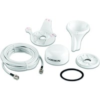
Ga 38 Gps/Glonass Antenna - 010-12017-00 - 322-0101201700F1
Built to take advantage of the GLONASS system/constellation of satellites as well as standard GPS, this robust external antenna is packaged in a low-profile waterproof housing and provides 3 easy mounting solutions: pole, surface or under-deck (for the underside of fiberglass decks). External GPS/GLONASS antennas provide increased flexibility and installation options as well as the potential for enhanced reception of GPS/GLONASS signal for those products with built-in GPS/GLONASS antennas.
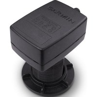
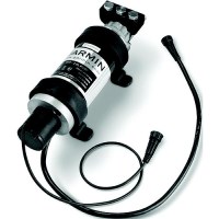
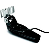
Garmin 0100070100 Intelliducer Nmea 2000, 0-12° Tilt - 010-00701-00 - 322-0100070100F1
This intelliducer enhances your boat's marine instrumentation capabilities by providing both depth and temperature data to your NMEA 2000 Garmin digital marine display or chartplotter. The 150 W thru-hull mount has a maximum depth of 900 ft; an operating frequency of 160 kHz; and mounts on a 0-to-12-degree deadrise. Transducer kit comes with installation instructions. Follow the instructions carefully to avoid damaging your boat.
Garmin 0100070101 Intelliducer Nmea 2000, 13-24° Tilt - 010-00701-01 - 322-0100070101F1
This intelliducer enhances your boat's marine instrumentation capabilities by providing both depth and temperature data to your NMEA 2000 Garmin digital marine display or chartplotter. The 150 W thru-hull mount has a maximum depth of 900 ft; an operating frequency of 160 kHz; and mounts on a 0-to-12-degree deadrise. Transducer kit comes with installation instructions. Follow the instructions carefully to avoid damaging your boat.
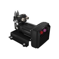
Garmin 0100070562 Smartpump V2 Autopilot Pump, 12/24V - 010-00705-62 - 322-0100070562F1
Put an end to guessing which pump size will work with your particular boat. One SmartPump V2 works for most hydraulically steered boats and applications. For optimum control and confidence, you know you have the right pump for your boat. Plus, you get complete control in a smaller size with better thermal performance, higher reliability and lower power consumption. It also includes color-coded connectors to make it very easy to install. Dimensions (H x W x D): 6.6" x 7.5" x 10.4" (167.6 x 190.5 x 264.16 mm)Weight: 16.5 lbs (7.5 kg)Temperature range: From 5°F to 131°F (from -15°C to 55°C)Material: Electronics Control Unit (ECU) - fully gasketed, aluminum alloy; bracket - carbon steel; manifold - aluminum alloy; motor - aluminum alloyPower cable length: 9 ft (2.7 m)Power input: 10-30 VdcFuse: 40 A, blade-typeMain power usage: standby - less than 1 A; engaged - 5-10 A; peak - 34 AFlow rate: Configurable from 0 to 2.4 L per minuteCompatible with steering cylinder sizes from 4-24 cu in; 7 second lock to lock up to 17 cu in
Garmin 0100070563 2.0L Autopilot Hydraulic Pump Kit - 010-00705-63 - 322-0100070563F1
Pump kit for Reactor™ 40 systems. Now with improved ORB hydraulic ports and threaded cable collars for increased durability. 4.3" x 4.4" x 1.9"
Garmin 0100070564 1.2L Autopilot Hydraulic Pump Kit - 010-00705-64 - 322-0100070564F1
Pump kit for Reactor™ 40 systems. Now with improved ORB hydraulic ports and threaded cable collars for increased durability. 4.3" x 4.4" x 1.9"
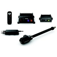
Garmin 0100070595 Reactor™ 40 Kicker Autopilot W/O Display - 010-00705-95 - 322-0100070595F1
Whether you're going for salmon, trout, walleye or some other species or just taking your sailboat out of the marina, your Reactor 40 kicker autopilot can help you maintain heading hold and route to keep you on course - even against wind, waves or heavy current. Specially designed for boats with small gasoline outboard motors up to 25 horsepowerHelps maintain heading hold and route to keep you on course - even against wind, waves or heavy currentIncludes convenient floating handheld remote control with a bright, sunlight-readable displayEasily fine-tune autopilot throttle setting with the touch of a button to quickly drop to idle speed when netting a fishEasy to install and integrate with GHC 20 autopilot display, compatible Garmin chartplotters or NMEA 2000 network-compatible GPS system Go to Garmin.com for supported motors & erquired accessories.
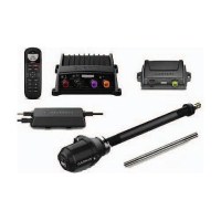
Garmin 0100070595 Reactor™ 40 Kicker Autopilot W/Stainless Tilt Tube, W/O Display - 010-00705-96 - 322-0100070596F1
Whether you're going for salmon, trout, walleye or some other species or just taking your sailboat out of the marina, your Reactor 40 kicker autopilot can help you maintain heading hold and route to keep you on course - even against wind, waves or heavy current. Specially designed for boats with small gasoline outboard motors up to 25 horsepowerHelps maintain heading hold and route to keep you on course - even against wind, waves or heavy currentIncludes convenient floating handheld remote control with a bright, sunlight-readable displayEasily fine-tune autopilot throttle setting with the touch of a button to quickly drop to idle speed when netting a fishEasy to install and integrate with GHC 20 autopilot display, compatible Garmin chartplotters or NMEA 2000 network-compatible GPS systemStainless-steel tilt tube replaces the mild steel tilt tube on Yamaha® and Honda outboards Go to Garmin.com for supported motors & erquired accessories.
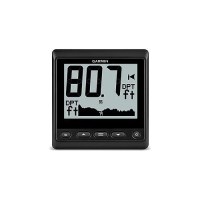
Garmin 0100114200 Gnx™ 20 Marine Instument - 010-01142-00 - 322-0100114200F1
Large, easy-to-read black digits and graphs on a white or color background provides high contrast and high visibility; choose from 7 customizable backlight colors Glass-bonded display with anti-glare lens avoids foggingFully customizable user profiles for sail or power boating to display most important marine and vessel dataLow power consumption (25 mA) with 350 mW (no backlight)/400 mW (mid-level backlight)5 display configurations plus gauge and graph mode to display depth, speed, wind and 50+ marine and boat parameters Includes: GNX 20, Trim piece snap cover, Protective cover, Flush mount gasket and hardware, NMEA 2000 T-connector, NMEA 2000 drop cable
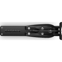
Garmin 0100136410 Gmr Fantom™ Pedestal Only, 50W White - 010-01364-10 - 322-0100136410F1
GMR Fantom™ solid-state radars use MotionScope™ technology to detect and highlight moving targets in different colors, which helps you avoid potential collisions, find flocks of birds and track weather. Their Pulse Compression technology provides high-resolution imaging and maximizes energy to help you detect and identify targets. True echo trails gives you a fading trail on moving targets while accounting for the movement of your boat. Auto bird gain helps you identify flocks of birds on the water.
Garmin 0100136500 Gmr Fantom™ Antenna Array Only, 4' White - 010-01365-00 - 322-0100136500F1
GMR Fantom™ solid-state radars use MotionScope™ technology to detect and highlight moving targets in different colors, which helps you avoid potential collisions, find flocks of birds and track weather. Their Pulse Compression technology provides high-resolution imaging and maximizes energy to help you detect and identify targets. True echo trails gives you a fading trail on moving targets while accounting for the movement of your boat. Auto bird gain helps you identify flocks of birds on the water.
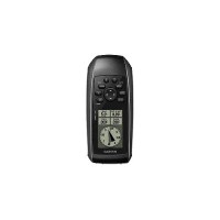
Garmin 0100150400 Gps 73 Floating Handheld Gps - 010-01504-00 - 322-0100150400F1
This easy-to-use handheld is the perfect navigational solution for boats, sailboats or small watercraft that do not have a chartplotter. it's also ideal as an important emergency navigation backup for all vessels. It's high-sensitivity GPS marks and stores 1,000 waypoints and 100 tracks so you can navigate right back to them. Use on land or water - it floats! Features SailAssist, including virtual starting line, heading line, countdown timers and tack assist. High-sensitivity GPS receiverMarks and stores 1,000 waypoints and 100 tracksMarks your favorite locations to easily navigate back to themGarmin SailAssist™ for GPS 73 includes virtual starting line, heading line, countdown timers and tack assistSunrise/sunset, estimated time of arrival, other calculations and marine dataBuilt-in backlight
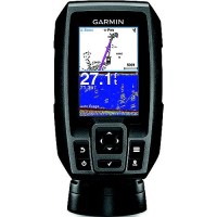
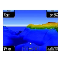
Garmin 0100155000 Striker™ 4 Fishfinder W/Gps, 3.5" Display - 010-01550-00 - 322-0100155000F1
Share your favorite waypoints and routes with other STRIKER and echoMAP™ combos. Smooth Scaling™ graphics provide uninterrupted imagery when switching between depth-range scales. Sonar history rewind allows you to scroll back through sonar images to mark waypoints you originally may have missed. Plus, it has a built-in flasher and displays speed data. Easy-to-use color fishfinder w/built-in, high-sensitivity GPSFind fish, mark and return to hot spots, docks and rampsConvenient keypad operationIncludes CHIRP (77/200 kHz) sonar transducerTransmit power (200 W RMS)/(1,600W peak-to-peak), with transom/trolling motor mount and tilt/swivel mount.Upgrade to high performance CHIRP w/GT8 or GT15 transducer (sold separately)
Garmin 0100174000 Gpsmap® 1022 10" Gps/Chartplotter - 010-01740-00 - 322-0100174000F1
Designed for cruisers, sailors and sailing racers who need the advanced all-in-1 solution provided by our 10" keyed chartplotter. Features a large, bright screen coupled with a quick and easy-to-use keypad interface with user-programmable keys and a multifunction control knob. Garmin Marine Network support allows sharing of sonar, maps, user data, dome or open-array radar, IP cameras and Panoptix™ sonar among multiple units. Includes NMEA 2000 network connectivity and NMEA 0183 support for autopilots, digital switching, weather, FUSION-Link, VHF, AIS and other sensors. Color display with keypad interface and multifunction control knobHigh-sensitivity internal 10 Hz GPS and GLONASS receiverFully network capable for Garmin Marine Network and NMEA 2000® plus NMEA 0183 supportSupports optional BlueChart® g3 Vision® premium charts
Garmin 0100174050 Gpsmap® 1042Xsv Gps Chartplotter W/O Transducer - 010-01740-50 - 322-0100174050F1
Large, bright screens with quick and easy-to-use keypad interfaces with user-programmable keys and multifunction control knobs for ease of use. Wide viewing angles on a vivid color displayNavigate confidently with built-in Garmin Navionics+™ inland and coastal mappingCompatible with our premium maps and charts for the best in Garmin navigationSee what's around your boat with built-in sonar capabilities on select models (transducers sold separately)Include built-in single-channel CHIRP sonar plus CHIRP ClearVü™ and CHIRP SideVü™ scanning sonars with Panoptix™ and LiveScope™ sonar support on select models (transducers sold separately)Built-in ANT wireless connectivity directly to your compatible Garmin devices such as quatix® marine watches, gWind™ Wireless 2 transducers, GNX™ Wind marine instruments and wireless remote controlsBuilt in Wi-Fi® technology gives you access to the free all-in-one ActiveCaptain app, so you can manage your marine experience from nearly anywhere on your compatible smartphoneNetwork capable for the Garmin Marine Network and NMEA 2000® networking plus NMEA 0183 technology supportEngine connectivity, read RPMs, fuel flow, temperature, trim and other important information at a glance. Check with your engine manufacturer for additional hardware needs.

Garmin 0100174060 Gpsmap® 1042Xsv Gps Chartplotter W/Gt52Hw-Tm Transducer - 010-01740-60 - 322-0100174060F1
Large, bright screens with quick and easy-to-use keypad interfaces with user-programmable keys and multifunction control knobs for ease of use. Wide viewing angles on a vivid color displayNavigate confidently with built-in Garmin Navionics+™ inland and coastal mappingCompatible with our premium maps and charts for the best in Garmin navigationSee what's around your boat with built-in sonar capabilities on select models (transducers sold separately)Include built-in single-channel CHIRP sonar plus CHIRP ClearVü™ and CHIRP SideVü™ scanning sonars with Panoptix™ and LiveScope™ sonar support on select models (transducers sold separately)Built-in ANT wireless connectivity directly to your compatible Garmin devices such as quatix® marine watches, gWind™ Wireless 2 transducers, GNX™ Wind marine instruments and wireless remote controlsBuilt in Wi-Fi® technology gives you access to the free all-in-one ActiveCaptain app, so you can manage your marine experience from nearly anywhere on your compatible smartphoneNetwork capable for the Garmin Marine Network and NMEA 2000® networking plus NMEA 0183 technology supportEngine connectivity, read RPMs, fuel flow, temperature, trim and other important information at a glance. Check with your engine manufacturer for additional hardware needs.
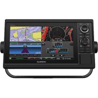
Garmin 0100174100 Gpsmap® 1222 12" Gps/Chartplotter - 010-01741-00 - 322-0100174100F1
Designed for cruisers, sailors and sailing racers who need the advanced all-in-1 solution provided by our 10" keyed chartplotter. Features a large, bright screen coupled with a quick and easy-to-use keypad interface with user-programmable keys and a multifunction control knob. Garmin Marine Network support allows sharing of sonar, maps, user data, dome or open-array radar, IP cameras and Panoptix™ sonar among multiple units. Includes NMEA 2000 network connectivity and NMEA 0183 support for autopilots, digital switching, weather, FUSION-Link, VHF, AIS and other sensors. Color display with keypad interface and multifunction control knobHigh-sensitivity internal 10 Hz GPS and GLONASS receiverFully network capable for Garmin Marine Network and NMEA 2000® plus NMEA 0183 supportSupports optional BlueChart® g3 Vision® premium charts
Garmin 0100174150 Gpsmap® 1242Xsv Gps Chartplotter W/O Transducer - 010-01741-50 - 322-0100174150F1
Large, bright screens with quick and easy-to-use keypad interfaces with user-programmable keys and multifunction control knobs for ease of use. Wide viewing angles on a vivid color displayNavigate confidently with built-in Garmin Navionics+™ inland and coastal mappingCompatible with our premium maps and charts for the best in Garmin navigationSee what's around your boat with built-in sonar capabilities on select models (transducers sold separately)Include built-in single-channel CHIRP sonar plus CHIRP ClearVü™ and CHIRP SideVü™ scanning sonars with Panoptix™ and LiveScope™ sonar support on select models (transducers sold separately)Built-in ANT wireless connectivity directly to your compatible Garmin devices such as quatix® marine watches, gWind™ Wireless 2 transducers, GNX™ Wind marine instruments and wireless remote controlsBuilt in Wi-Fi® technology gives you access to the free all-in-one ActiveCaptain app, so you can manage your marine experience from nearly anywhere on your compatible smartphoneNetwork capable for the Garmin Marine Network and NMEA 2000® networking plus NMEA 0183 technology supportEngine connectivity, read RPMs, fuel flow, temperature, trim and other important information at a glance. Check with your engine manufacturer for additional hardware needs.
Garmin 0100174160 Gpsmap® 1242Xsv Gps Chartplotter W/Gt52Hw-Tm Transducer - 010-01741-60 - 322-0100174160F1
Large, bright screens with quick and easy-to-use keypad interfaces with user-programmable keys and multifunction control knobs for ease of use. Wide viewing angles on a vivid color displayNavigate confidently with built-in Garmin Navionics+™ inland and coastal mappingCompatible with our premium maps and charts for the best in Garmin navigationSee what's around your boat with built-in sonar capabilities on select models (transducers sold separately)Include built-in single-channel CHIRP sonar plus CHIRP ClearVü™ and CHIRP SideVü™ scanning sonars with Panoptix™ and LiveScope™ sonar support on select models (transducers sold separately)Built-in ANT wireless connectivity directly to your compatible Garmin devices such as quatix® marine watches, gWind™ Wireless 2 transducers, GNX™ Wind marine instruments and wireless remote controlsBuilt in Wi-Fi® technology gives you access to the free all-in-one ActiveCaptain app, so you can manage your marine experience from nearly anywhere on your compatible smartphoneNetwork capable for the Garmin Marine Network and NMEA 2000® networking plus NMEA 0183 technology supportEngine connectivity, read RPMs, fuel flow, temperature, trim and other important information at a glance. Check with your engine manufacturer for additional hardware needs.
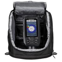
Garmin 0100187030 Striker™ Plus 4 Ice Fishing Bundle - 010-01870-30 - 322-0100187030F1
STRIKER Plus 4 fishfinder with a bright 4.3" display and built-in GPS capibility Dual-beam ice fishing transducer with Garmin traditional sonar for crystal-clear images and remarkable target separationWaypoint marking for hot spots so you can easily find your way backStore up to 2 million acres of maps with 1' contoursFish year round Get a Garmin GT8 or GT15 transducer (each sold separately), and the STRIKER Plus 4 fishfinder works on open waterRugged, portable carrying case lets you easily transport it from hole to hole and season to season Kit Includes: STRIKER™ Plus 4 fishfinder, Dual Beam-IF transducer, Power/data cable, Tilt/swivel mount, Hardware, Garmin bumper sticker, Bag with handle, Foam float, Rechargeable battery & Battery charger.
Garmin 0100196000 Gt-20Tm Transom Or Trolling Motor Mount Chirp Downvü Transducer, 4-Pin - 010-01960-00 - 322-0100196000F1
Perfect for the shallow water fisherman who want traditional and CHIRP ClearVü scanning sonar, this transom or trolling motor mounted transducer consistently displays fish arches as well as clear pictures of objects, structure and fish that pass below your boat. The 20 ft transducer cable with built-in fast response temperature sensor has a power rating of 500 W; a depth of 1,900 ft (traditional) and 750 ft (ClearVü); an operating frequency of 77/200 kHz (traditional) and 455 kHz (ClearVü); and a 0 to 70 transom angle. Transducer comes with transom and trolling motor mounts, and installation instructions. Follow the instructions carefully to avoid damaging your boat.
Garmin 0100196001 Gt-20Tm Transom Or Trolling Motor Mount Chirp Downvü Transducer, 8-Pin - 010-01960-01 - 322-0100196001F1
Perfect for the shallow water fisherman who want traditional and CHIRP ClearVü scanning sonar, this transom or trolling motor mounted transducer consistently displays fish arches as well as clear pictures of objects, structure and fish that pass below your boat. The 20 ft transducer cable with built-in fast response temperature sensor has a power rating of 500 W; a depth of 1,900 ft (traditional) and 750 ft (ClearVü); an operating frequency of 77/200 kHz (traditional) and 455 kHz (ClearVü); and a 0 to 70 transom angle. Transducer comes with transom and trolling motor mounts, and installation instructions. Follow the instructions carefully to avoid damaging your boat.
Garmin 0100196100 Gt30-Tm Clearvü And Sidevü Transom Mount Transducer - 010-01961-00 - 322-0100196100F1
Perfect for the shallow water fisherman who want CHIRP ClearVü and CHIRP SideVü scanning sonar, this transom mount transducer consistently displays clear definition of objects, structure and fish below and to each side of the boat. The 20 ft transducer cable with built-in fast response temperature sensor has a power rating of 500 W per element (1,500 W total); a depth of 750 ft (ClearVü) and 500 ft left and right (SideVü); an operating frequency of 455/800 kHz; and a 0 to 70 transom angle. Pair it with your GCV™ 10 black box sonar. Transducer comes with installation instructions. Follow the instructions carefully to avoid damaging your boat.

Garmin 0100196110 Gt30 Chirp Clearvü & Sidevü Thru-Hull Transducer, Single - 010-01961-10 - 322-0100196110F1
Perfect for the shallow water fisherman who wants CHIRP ClearVü and CHIRP SideVü scanning sonar with a stainless steel stem, this 12-pin thru-hull transducer consistently displays clear definition of objects, structure and fish below and to each side of the boat. The transducer with built-in fast response temperature sensor has a power rating of 500 W per element (1,500 W total); a depth of 750' (ClearVü) and 500 ft left and right (SideVü); an operating frequency of CHIRP 455/800 kHz; for hull deadrises less than 5°. Pair it with your GCV™ 10 scanning sonar module.
Garmin 0100196111 Gt30 Chirp Clearvü & Sidevü Thru-Hull Transducer, Pair - 010-01961-11 - 322-0100196111F1
Perfect for the shallow water fisherman who wants CHIRP ClearVü and CHIRP SideVü scanning sonar with a stainless steel stem, this 12-pin thru-hull transducer consistently displays clear definition of objects, structure and fish below and to each side of the boat. The transducer with built-in fast response temperature sensor has a power rating of 500 W per element (1,500 W total); a depth of 750' (ClearVü) and 500 ft left and right (SideVü); an operating frequency of CHIRP 455/800 kHz; for hull deadrises less than 5°. Pair it with your GCV™ 10 scanning sonar module.
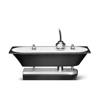
Garmin 0100196610 Gt51M-Th Downvü/Sidevü Thru-Hull Transducer, 12 Pins - 010-01966-10 - 322-0100196610F1
This thru-hull transducer provides ultra-clear sonar pictures of objects, structure and fish that pass below your boat. This traditional CHIRP sonar and CHIRP DownVü/SideVü transducer is optimized for depth performance and rough conditions. It includes a built-in fast-response temperature sensor. For hull deadrises less than 5 degrees. GT51M-TH includes: 12-pin transducer with stainless steel stem, fairing block, isolation plate and bushings, mounting hardware and installation instructions.
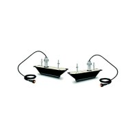
Garmin 0100196611 Gt51M-Thp Clearvü And Sidevü Thru-Hull Pair Transducer, 5', 12 - 010-01966-11 - 322-0100196611F1
Perfect for the coastal and offshore fisherman who want CHIRP traditional sonar, CHIRP ClearVü and CHIRP SideVü scanning sonar with stainless steel stems, this pair of thru-hull mounted transducers consistently displays clear and crisp fish arches with superior target separation as well as clear pictures of objects, structure and fish that pass below and to each side of your boat and is optimized for rough sea conditions. The CHIRP ClearVü/ SideVü elements have a power rating of 500 W per element and operating frequencies of 260/455 kHz. The traditional CHIRP sonar has a power rating of 600 W and operating frequencies of mid-band CHIRP 80-160 kHz. It includes a built-in fast-response temperature sensor. For hull deadrises less than 25 degrees. GT51M-THP includes a 12-pin port/starboard transducers with stainless steel stems, fairing blocks, Y-cable, bushings, mounting hardware and installation instructions. Follow the instructions carefully to avoid damaging your boat.
Garmin 0100202400 Force™ Bow Mount Trolling Motor, 24/36V, 80/100 Lb. Thrust, 50" Shaft - 010-02024-00 - 322-0100202400 Superseded By: 322-0100301100F1
Wireless chartplotter connectivity provides navigation, autopilot and anchor lock features. Use the precise anchor lock to hold your boat in the same location while you fish. Force includes a convenient wireless foot pedal that provides instant control and responsiveness yet feels and steers like a cable-steered pedal. See more fish and structure clearly with integrated Ultra High-Definition scanning sonar. It also includes a handheld remote control with a built-in sunlight-readable display. The remote gives you complete control of the trolling motor and simple point-and-go gesture steering. Sonar Frequencies Supported: CHIRP sonar: High-wide CHIRP (150-240 kHz), ClearVu: Ultra-high definition 800 kHz, SideVu: Ultra-high definition 1200 kHz and 455 kHz Sonar Partial Frequencies Supported: CHIRP Sonar: High-wide CHIRP (150-240 kHz) ClearVü: 800 kHz, SideVü: 455 kHz Built-in Sonar with Depth & TemperatureBuilt-in GPS & Heading SensorAutopilot Functions; Route Following, Anchor Lock, Gestures Heading Hold & Cruise ControlDual Gas Spring Lift AssistFoot Pedal & Wireless Remote IncludedBattery IndicatorVariable Speed ControlMax Thrust of 100 lbs. at 36VDC3 year warranty