
Maptech
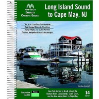
Long Island Sound Embassy Guide - Cglis-15 - 157-Cglis15F1
These large format, easy to read books are the perfect navigation companion for planning a trip or when underway. Find the information and detailed navigation advice quickly and easily by writers who have traveled all these areas. Harbors are indexed by chapters and marina and facility locations cross-reference quickly with harbor chart segments. Spiral bound, wrap-around covers are designed for ease-of-use and lay flat. Facilities tables display key information so you can quickly find the "right" facility. Full-color harbor chart segments show marina approaches and bird's-eye aerial photos of harbor entrances improve situational awareness during approaches. Beautiful pictures highlight local landmarks and vistas you may see underway or at anchor.
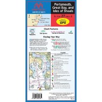
Portsmouth, Great Bay, And Isles Of Shoals, Edition 3 - Wpc027-03 - 157-Wpc02703F1
Maptech waterproof charts are a big improvement over large, cumbersome charts. Spread a chart out to its full width, or keep it folded and flip to your favorite area. Waterproof and tear-resistant and pre-plotted courses.